Explore the many boardwalks and jetties our region has to offer, or launch your boat from one of the many boat ramps that are available.
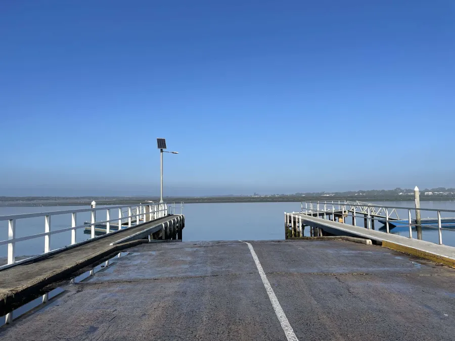
Our region offers many boat ramps to access fantastic fishing yachting off shore diving and recreational boating opportunities.
Our jetties and boardwalks provide opportunities to experience the beauty and wildlife of Corio Bay for walkers birdwatchers and fishers.
Boat ramps
Boat ramps can be found from sheltered coves within inner Corio Bay to excellent bay rip and open water boating experiences in Port Phillip and beyond.
Providing access to the bay and open water for recreational commercial and economic purposes is an intrinsic value of the Australian way of life.
Visit the Boating Vic website for location maps images and current launching conditions for individual boat ramps.
Various governing bodies manage the many boat ramps within our municipality - below is a brief guide to each ramp.
| Ramp | Access | Description |
|---|---|---|
| Barwon Heads and Ocean Grove | ||
| Bellarine Peninsula | ||
| Central Geelong | ||
| Corio Bay | ||
| Ocean Grove | Guthridge Street | Large two lane boat ramp. Floating pontoons fish cleaning table solar lighting. |
| Significant tidal range with strong current and medium water depth | ||
| Experienced boat operations with small to medium boats recommended | ||
| Parking toilets and picnic facilities available | ||
| Clifton Springs | Jetty Road | Access through a large car park medium water depth though shallow areas at low tides |
| Small to medium boats recommended | ||
| Two double ramps and an additional ramp for smaller vessels such as jet skis during peak periods | ||
| A sheltered site from most conditions | ||
| Parking toilets and fish cleaning facilities available | ||
| Limeburners Point Boat Harbour | Hearn Parade | Concrete 3 lane boat ramp with an additional ramp for smaller vessels such as jet skis during peak periods |
| Breakwater and pontoons | ||
| A sheltered site from most conditions; Deep water depth | ||
| Fish cleaning plenty of parking and toilets available | ||
| Point Henry Beach | Informal Point Henry Road | Beach launching only |
| Low energy beach and spit entrance to Corio Bay | ||
| Shallow water great for kayak/canoes | ||
| No vehicle assisted boat launching permitted | ||
| Parking and toilets available | ||
| St Helens Boat Harbour | Swinburne Street North Geelong | Concrete three lane boat ramp and 2 floating pontoons available |
| A sheltered launching area under most conditions | ||
| Toilets fish cleaning and picnic facilities available | ||
| No launching fee - Please consider a donation to Australian Volunteer Coast Guard Association - 03 5278 8440 | ||
| Avalon Beach boat ramp | Avalon Road | Low energy beach with sand flats exposed at low tide |
| Two lane boat ramp shallow water smaller boats recommended | ||
| Parking toilets boarding jetty and fish cleaning table | ||
| Corio Bay Boat Club | Foreshore Road (northern end) | Beach launching only |
| Sheltered shallow site moderate tidal range | ||
| Small sized boats recommended | ||
| Grammar School Lagoon | Foreshore Road (central) | Concrete 2 lane ramp moderate tidal range sheltered shallow site |
| Very small sized craft recommended | ||
| Parking available | ||
Note: We do not manage Cunningham Pier nor ramps or jetties within marinas.
Visit Bellarine Bayside or phone 03 5254 4000
| Access | Description | |
|---|---|---|
| Indented Head | The Esplanade | Concrete two lane boat ramp and timber loading jetty |
| Moderate tidal range exposed to the east shallow at low tide | ||
| Small to medium sized boats recommended | ||
| Toilets and parking available | ||
| Point Richards | Point Richards Road Melways: 444 C4 | Concrete four lane ramp timber loading jetty. Upgraded to increase shelter and facilitate dredging 2022. |
| Moderate tidal range exposed to the north | ||
| Shallow water small to medium sized boats recommended | ||
| Parking and toilets available | ||
| Portarlington Caravan Park | via Caravan Park | Restricted access to caravan park |
| Concrete four lane boat ramp moderate tidal range and medium water depth | ||
| Toilets parking wash down and fish cleaning facilities available inside Park | ||
| Portarlington Fairfax Street | Fairfax Street | Concrete one lane boat ramp with loading jetty |
| Moderate tidal range exposed to the west and north | ||
| Shallow small boats recommended | ||
| Toilet and parking available | ||
| St Leonards | Bluff Road | Concrete four lane boat ramp timber jetty moderate tidal range exposed to the east medium water depth |
| Small to medium sized boats recommended | ||
| Fish cleaning facilities toilets and parking available |
Visit Parks Victoria or phone 131 963
| Ramp | Access | Description |
|---|---|---|
| Barwon Heads and Ocean Grove | ||
| Bellarine Peninsula | ||
| Corio Bay | ||
| Barwon Heads | Minah Street | Rolled crushed rock boat ramp |
| Large tidal range significant tidal current | ||
| Shallow site very small non-powered craft recommended | ||
| Picnic facilities and limited parking available | ||
| River Parade | One lane concrete boat ramp one pontoon | |
| Large tidal range tidal current significant medium water depth small to medium boats recommended | ||
| Clifton Springs | Jetty Road | Access through a large car park medium water depth though shallow areas at low tides |
| Small to medium boats recommended | ||
| Two double ramps and an additional ramp for smaller vessels such as jet skis during peak periods | ||
| A sheltered site from most conditions | ||
| Parking toilets and fish cleaning facilities available | ||
| Swan Bay | Swan Bay Road | Concrete single lane boat ramp shallow water depth recommended for smaller boats |
| The jetty is difficult to launch and retrieve boats with strong to moderate North winds need to use caution | ||
| Parking toilets and picnic tables available | ||
| Kirk Point/Murtcain Boat Ramp | Beach Road Point Wilson | Shallow water smaller boats recommended |
| Exercise caution to avoid rocks | ||
| Sheltered to the north and west | ||
| Limited parking available | ||
Jetties and boardwalks
We manage the facilities listed below.
| Ramp | Access | Description |
|---|---|---|
| Central Geelong | ||
| Griffin Gully jetty | corner of Western Beach Road and The Esplanade | Fishing platform, solar lighting |
| Eastern Beach Promenade | Ritchie Boulevard | Views, wheelchair access, swimming and diving areas - patrolled in Summer. |
| Clifton Springs | ||
| Fishing jetty | Jetty Road | Pole holders, benches, solar lighting |
| The Dell Boardwalk | Vehicles: Springs Street Note: Accessible ramp, 1:10 gradient. | Views, historic area, interpretive signage, access to snorkelling area. Note: Boardwalk does not provide wheelchair access beyond The Dell. |
| Corio | ||
| Geelong Grammar Jetty | Foreshore Road (northern end) | Fish cleaning table |
| North Geelong | ||
| Mackey Street breakwater | Mackey Street | Fishing platform, pole holders, limited lighting |
| St Helens Harbour rockwalls | Swinburne Street | Pole holders, fish cleaning table, solar lighting |
| St Helens jetty | Bay Street or Swinburne Street | Access to swimming area |
| Rippleside jetty | Rippleside Park Drive | Benches, pole holders, solar lighting, wheelchair access. |
| Western Cliffs boardwalk | Rippleside Park or The Esplanade (pedestrian only) | Viewing areas, benches, interpretive signs, wheelchair access. |
| North Shore | ||
| Lascelles fishing jetties | The Esplanade (south of Sea Breeze Parade) | Benches, pole holders, solar lighting |
Boating Information
Better Boating Victoria has a website which includes current information on all Victorian boat ramps as well as links to boating safety information. https://www.boating.vic.gov.au/ramps
Common Questions
In general we are responsible for public beaches and boat ramps between Avalon Beach to Ramblers Road, Portarlington.
We also:
- have responsibility for the Ocean Grove boat ramp and Buckley Park foreshore between Point Lonsdale to Collendina
- manage a small section of beach adjacent to Harvey Park at St Leonards.
Bellarine Bayside is generally responsible for beaches and boat ramps from Point Richards to the edge of the Edwards Point Wildlife Reserve.
Parks Victoria manage or are responsible for:
- Portarlington Harbour and Edwards Point Wildlife Reserve
- Portarlington Harbour and Edwards Point Wildlife Reserve and
- all coastal waters below low tide mark, Marine Protected Areas and State Reserves, for example: Lake Connewarre.
Barwon Coast is responsible for public coastal foreshores between Collendina and Breamlea.
There are several other agencies responsible for specific coastal areas such as the Geelong Ports Authority, Barwon Water, the Department of Energy, Environment and Climate Action (DEECA) and the Department of Defence.
I want to...
Related information
Page last updated:
We are glad that you find this page helpful!
Submitting feedback... Please wait.
An error occured! Please try again.
Feedback submitted successfully!
Thank you for your feedback. We value your input and will use it to improve our services.