The Horseshoe Bend Precinct is located in the central - eastern part of the Armstrong Creek Growth area.
Armstrong Creek - Horseshoe Bend Precinct
The Horseshoe Bend area is approximately 640 hectares. Residential development has started and once fully developed the population is estimated to be around 20 500.
The Horseshoe Bend Road will become the central boulevard through this precinct providing access to all key community facilities including a Neighbourhood Activity Centre a Local Activity Centre several schools and several active open space areas. Greenways will provide links to adjacent precincts and their key open space areas.
Greater Geelong Planning Scheme
Planning Scheme Amendment C259 introduced the Horseshoe Bend Precinct Structure Plan Horseshoe Bend Native Vegetation Precinct Plan and Horseshoe Bend Precinct Developer Contributions Plan into the Greater Geelong Planning Scheme.
Precinct Structure Plan Map
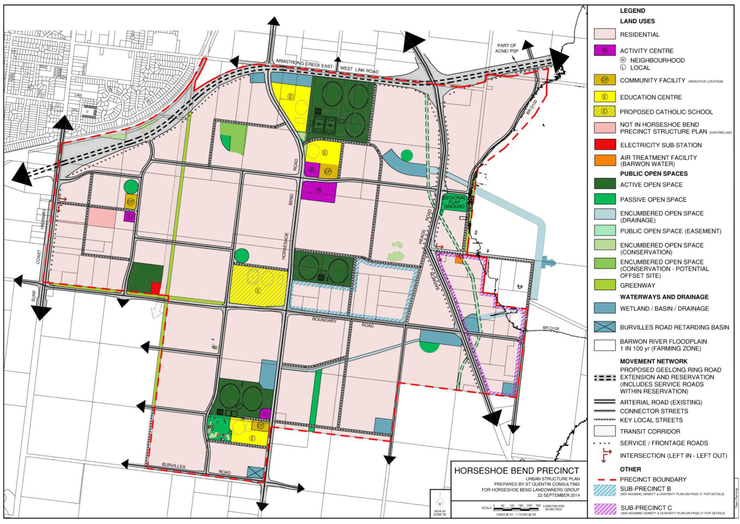
A PDF version of this map is available to download below under 'Documents'
Relevant documentation
Documents for consideration include the following:
- Armstrong Creek Horseshoe Bend Precinct - Precinct Structure Plan - September 2014
- Armstrong Creek Horseshoe Bend Precinct - Development Contributions Plan - September 2014
- Armstrong Creek Horseshoe Bend Precinct - Native Vegetation Precinct Plan - August 2014
All relevant and incorporated documents within the Planning Scheme can be found via the following link (search for 'Horseshoe Bend Precinct' in search bar to filter documents) Greater Geelong Planning Scheme - Docs
Help
For assistance, please contact Planning Delivery via: [email protected]
Page last updated: