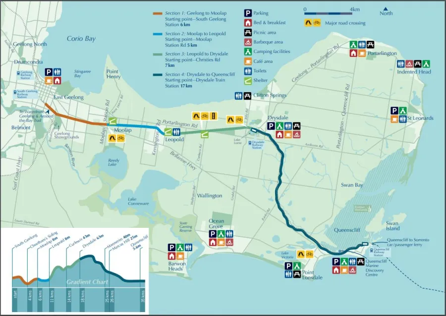
The Bellarine Rail Trail is a 35 kilometre trail that links South Geelong to Queenscliff following the alignment of the historical Geelong - Queenscliff Railway Line.
Bellarine Rail Trail
Geelong

Report an issue at a park, reserve or on public land.
The Bellarine Rail Trail is an approximately 35-kilometre shared-use trail linking South Geelong and Queenscliff, following the former Geelong–Queenscliff Railway Line. Beginning near the heart of Geelong, the trail passes through expanding suburban areas before reaching Drysdale, then continues alongside heritage rail services through rolling farmland to the coastal township of Queenscliff.
The Bellarine Rail Trail provides an inspiring passage to the many tourist attractions across the Bellarine Peninsula.
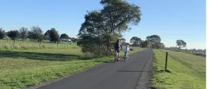
The trail pathway is asphalt between South Geelong and Drysdale and then primarily constructed of compacted crushed rock between Drysdale and Queenscliff. It provides a high quality surface suitable for most bikes other than those fitted with racing tyres.
The trail surface is sealed between South Geelong and Drysdale, transitioning to compacted crushed rock from Drysdale to Queenscliff.
Plan your trip
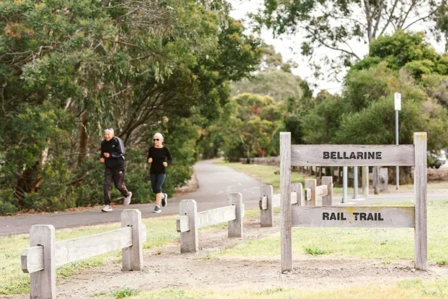
The trail is popular with weekend recreational cyclists as the 35 kilometre length one way makes for a safe ride with the added bonus of excellent views of the surrounding farmland and coast.
The gradient is mostly easy and flat with a gradual climb in some places. Families with young children often choose to avoid the return uphill climb from Queenscliff to Mannerim by either hopping on the steam train or arranging other transport.
South Geelong Station to Moolap Station road section is approximately 6km
Moolap to Christies Road Leopold section is approximately 5km, with toilets, shelter and drinking fountain at Fred Cooke Reserve
Leopold to Drysdale Station Reserve is approximately 7km, with toilets, playground, BBQ area and drinking fountain
Drysdale to Queenscliff station is approximately 17km, with shelter at Swan Bay Road and toilets at Suma Park in Mannerim
Emergency
ESTA Emergency Markers are installed along the trail. In an emergency, call 000 and quote the code on the marker post nearest to you. There are some crossings of major roads to watch out for. Major towns with all services include Geelong, Leopold, Drysdale and Queenscliff.
At times, Emergency Vehicles may be on the trail. Please reduce speed and pass with care.
Shared Trail behaviour
- Be mindful of other users to help keep the trail safe and enjoyable for everyone.
- Keep left and pass with care.
- Wear an approved helmet and suitable bright clothing.
- Cyclists should slow down near others and warn before overtaking.
- Be aware of road crossings and follow signage at all times.
- Dogs must be on a lead and under control.
- Be prepared for changing trail surfaces and conditions.
Native vegetation along the trail
The vegetation along the Bellarine Rail Trail is an important part of what makes this trail special. These plants provide habitat and food for local wildlife, including birds, insects and small animals. By staying on the path, respecting planted areas and sharing the trail responsibly, users help protect this valuable vegetation so it can continue to be enjoyed by the community and future generations.
Revegetation and maintenance works continue on an ongoing basis.
Friends of the Bellarine Rail Trail Inc. FBRT is committed to the indigenous revegetation of the 16-kilometre section of the Bellarine Rail Trail, between South Geelong and Drysdale Railway Stations.
Bellarine Landcare aims to preserve, protect and enhance the natural environment of the Bellarine Peninsula. We support productive and sustainable land use.
Swan Bay Environment Working with the community to protect Swan Bay.
Where
Dogs are to be controlled on leash in all public spaces unless otherwise signed. Penalties apply.
For more details view our dog walking map.


Page last updated: