The earlier sections of this Strategy have summarised a significant volume of information and highlight matters associated with land use and development of relevance to the Avalon Corridor.
ACS - Opportunities, constraints and issues
This section seeks to further summarise this background work into a list of opportunities constraints and issues to inform the Framework Plan.
The Avalon Corridor benefits from a unique combination of attributes that is not found elsewhere within Victoria.
However the role of this Strategy is to provide strategic guidance regarding appropriate development within targeted areas (based on relevant opportunities) and avoid development in inappropriate areas (based on relevant constraints).
- Princes Freeway and the Geelong-Melbourne rail corridor bisect the Avalon Corridor. Both constitute regionally significant major transport assets which provide substantial opportunity relating to the movement of freight and people and facilitate wider regional connections.
- Road and rail access to the Princes Freeway will be augmented by the future OMR Transport Corridor. The alignment for the OMR has been designated and formally protected through relevant planning scheme controls.
- Development at Avalon Airport is controlled by a federally endorsed Master Plan which anticipates major development and expansion of airport and non-airport activities in coming decades. Airport activities at Avalon Airport have the potential to expand without curfews or other operational constraints.
- Avalon Airport has potential to substantially expand on its status as Melbourne’s second international airport to further support Tullamarine Airport.
- Avalon Airport has potential for a future rail link which has been protected through a PAO.
- Substantial availability of undeveloped land both at and surrounding Avalon Airport and opportunity to leverage off the state significant transport gateway for economic growth and employment in the Avalon Corridor and wider region.
- The state policy designation of the future Bay West Port within the Avalon Corridor as the preferred location for Melbourne’s second port facility.
- Limited residential development to the south of the Princes Freeway with the exception of a small number of RLZ and FZ allotments west of Avalon Road.
- Transport opportunities associated with Geelong Fast Rail and the Western Rail Plan.
- Majority of the land to the south of the Princes Freeway accommodates the WTP which is in public ownership. This provides state government with the opportunity to maximise the value and use of the WTP site for Victorians through private sector and community partnerships in areas such as ecotourism circular economy and agriculture.
- WTP is a long term state significant infrastructure asset which will remain in long term operation to service metropolitan Melbourne. Ongoing operations provide opportunities for recycled water access by nearby farms and agricultural properties to the north of Princes Freeway (if cost and salinity challenges can be overcome).
- Preservation of views to Wurdi Youang (the You Yangs) as a regional landmark and tourism gateway.
- Potential to create artistic gateway features on the Princes Freeway to demarcate the edge of metropolitan Melbourne at Werribee and the entrance to Greater Geelong at Avalon Airport.
- Potential co-location of activities which have direct synergies with the ongoing activities at the Wyndham RDF and otherwise require buffers from urban areas.
- Potential to improve public access to the Port Phillip Bay coastline at appropriate points.
- Potential to protect environmental and biodiversity values associated with coastal environs and to explore opportunities these natural assets may offer including blue carbon climate change adaptation biodiversity offsets and ecotourism.
- Potential for aquaculture facilities both onshore (Crown parcel 2008\PP3891) and offshore (Bates Point Aquaculture Fisheries Reserve) on Crown and freehold land.
- Potential to improve local and regional cycling trails and shared path networks including the potential to complete missing link of the Port Phillip Bay Trail between Werribee and Geelong.
- Potential for rehabilitated quarries to have an innovative end use such as recreation or biodiversity conservation.
- Potential of regional extractive resources to supply the infrastructure and urban development needs for Melbourne and Geelong.
- Opportunity to protect enhance and celebrate living Wadawurrung cultural heritage
and values as well as sites of post contact heritage significance.
- Strong existing policy position to protect the role of the Avalon Corridor as a green break between Victoria’s two largest cities.
- Potential for future increased traffic to negatively impact on the functional operation of the Princes Freeway as the main regional access road between Melbourne Geelong and beyond.
- Rain shadows from Wurdi Youang and the Otway Ranges creating drier than average conditions in the Avalon Corridor (compared to the rest of southern Victoria).
- General constraints relating to farming rural activities and land management including water access weed and pest management bushfires access to networks and supplier inability to move goods due to existing vehicle restrictions on lower order roads.
- Current costs associated with producing recycled water of a suitable quality for agriculture exceed willingness to pay.
- Extent of residual land contamination within large sections of the WTP site due to historic land use activities.
- Significant environmental assets requiring careful management and protection including native grasslands riparian corridors coastal environs and Ramsar wetlands.
- Requirements for buffer separation from quarries (both current and future) Wyndham RDF and Point Wilson Munitions Facility.
- Landscapes character values and views associated with the foothills of Wurdi Youang.
- Need to manage potential biodiversity impacts of future land use change and development including expansion of services and road networks into critically endangered grassland EVCs.
- Need to limit impacts of development and operations of Avalon Airport on surrounding townships and settlements in Avalon Lara and Little River.
- Need to manage mitigate and avoid potential impacts of development on sites of identified cultural heritage significance.
- Gas and oil pipelines traversing the Avalon Corridor including the need to avoid sensitive land uses in relevant measurement lengths and to limit road crossings within easements.
- The requirement for landscaping along to gas and oil pipeline easements to maintain sight lines and avoid impacts of large tree roots.
- Potential amenity impacts for existing residential and rural living properties in Avalon Lara and Little River associated with significant future expansion of Avalon Airport and adjacent land to accommodate employment uses.
- Need to manage future traffic movements on Princes Freeway between Melbourne and Geelong and risks associated with increased volumes of freight and commuter vehicles.
- Need to protect areas required for development of the future Bay West Port through appropriate planning controls.
- Need to consider and manage potential impacts of Bay West Port on WTP and the adjoining sensitive coastal interface including the internationally significant Ramsar wetlands.
- Ensuring protection of the ongoing long-term operations of the WTP.
- Potential for further fragmentation of rural land located to the north of the Princes Freeway.
- Potential for small scale or incremental land use and development to be in conflict with broader strategic aspirations.
- Potential conflicts between present and future land uses north of the Princes Freeway with identified landscape character values.
- Potential conflicts between extractive industry aspirations with the Western Grasslands Reserve as well as other areas of high cultural environmental and landscape values.
- Exacerbated impacts of flooding inundation and sea level rise as a result of climate change.
- Need to further undertake assessments of cultural heritage significance for large tracts of the Avalon Corridor including the coastline of WTP.
- Need for planning to have a degree of flexibility in light of uncertainty over the future impacts of emerging technologies on industry manufacturing food production freight
logistics and employment.
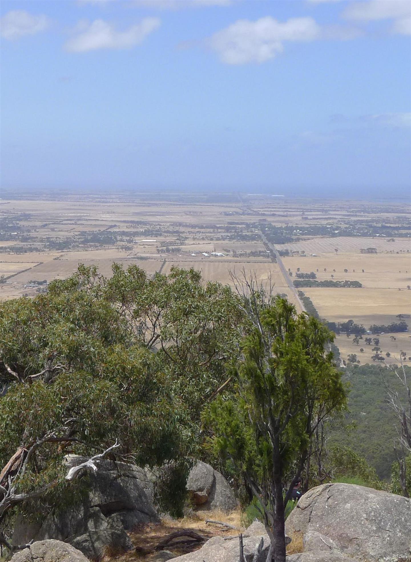
ACS - Views of the Avalon Corridor from Wurdi Youang
Page last updated: